
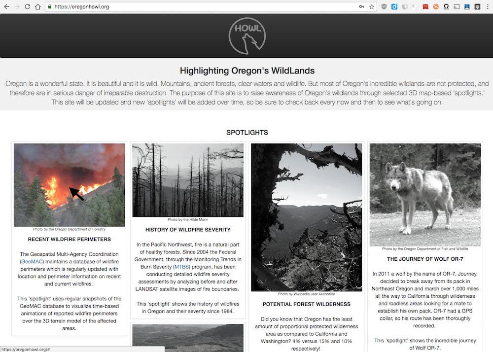
New HOWL Spotlight: Recent Wildfire Perimeters
3D time-based animation of recent (and current) wildfires in Oregon
I am pleased to announce that today I released a new HOWL ‘spotlight’ that maps recent (and current) wildfires in Oregon. This ‘spotlight’ displays wildfire data for the current and two past years from the GeoMAC database of fire perimeters.
The data comes from GeoMAC
The data for this ‘spotlight’ comes from the Geospatial Multi-Agency Coordination or GeoMAC. GeoMAC is a federal multi-agency program that disseminates information about wildfires in the United States. The program collects fire location and perimeter data from a variety of sources such as field reports, GPS data, and infrared imagery taken from airplanes and satellites.
For each incident recorded, GeoMAC keeps a collection of fire perimeter data (i.e., reports) as they are collected over time. The data is updated regularly and for current/active incidents it is available almost in real-time. For example, the 2017 Eagle Creek fire has 20 reports filed between September 3rd (just one day after the fire started), through October 3rd, and each report was available almost immediately after submitted.
Accessing the Recent Wildfire Perimeters ‘Spotlight’
To get to this HOWL ‘spotlight,’ just click on the corresponding card on the OregonHOWL site.
Or go directly to this url: https://oregonhowl.org/?view=rcwildfires
The top-level view
You will presented with a map zoomed into Oregon that shows a “flame” marker for each wildfire in the most recent year available. Wildfires of less than 1,000 acres are not included.
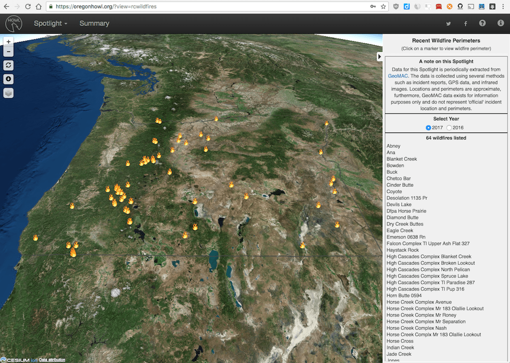
The year shown can be seen and changed on the right-side panel “Select Year” section.
You have two options for selecting a single fire and drill down to that individual incident. You can click on one of the “flame” markers, or you can click on one of the names shown on the right panel under the “XX wildfires listed” heading. After clicking on the individual fire either way, HOWL will fly to that fire and present the drill-down view.
The drill-down view
The drill-down view presents an orange colored shape overlayed on top of the terrain which corresponds with the perimeter of the most recent report kept by GeoMAC for that particular incident. The label at the top and center of the map will indicate the name of the wildfire, the date of the report and the acreage covered.
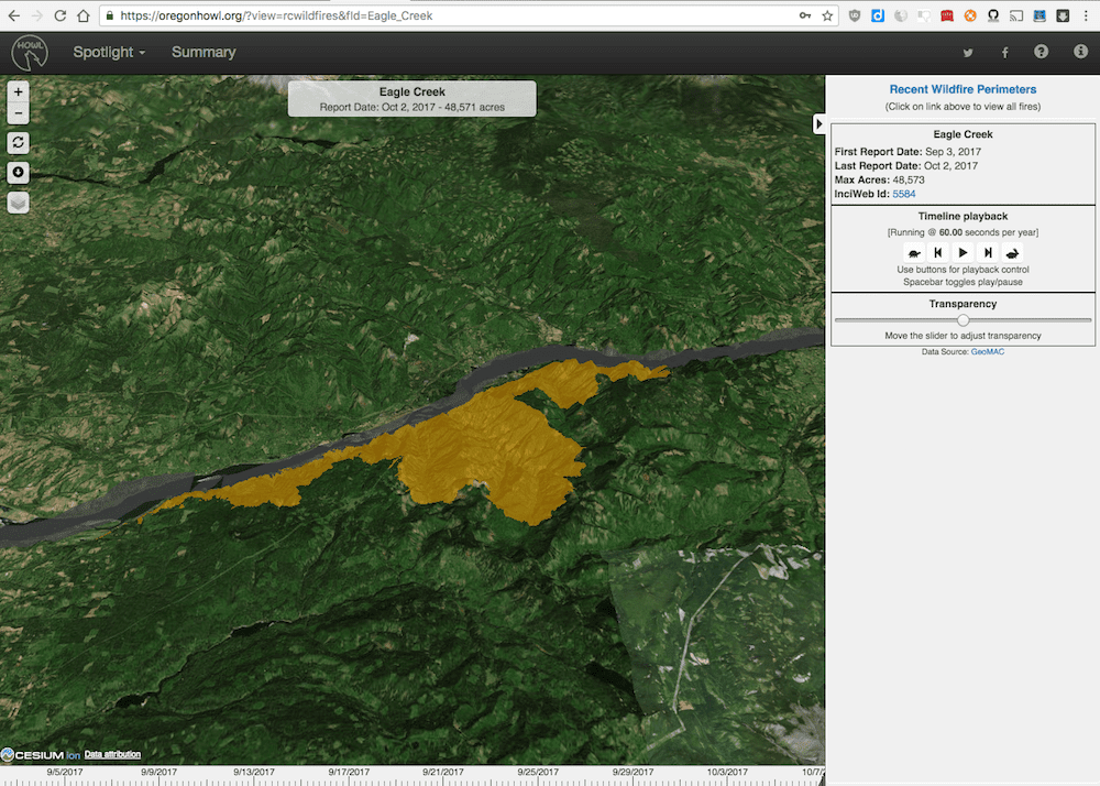
On the right panel you will see under the wildfire name heading, the dates of the first and the last report for the incident, along with the maximum number of acres reported. In addition, if available, a link to the official InciWeb incident takes you to a detailed official incident report.
If there is more than one report available, the timeline playback widget will be shown, which will allow you to playback an animation of the shapes corresponding with each report over time. This widget works exactly like in other HOWL ‘spotlights’ - Start, End, Play, Pause, Slower, and Faster. Or you can use the keyboard: Space - Play/Pause, Right Arrow - End, Left Arrow - Start, Up Arrow - Faster, Down Arrow - Slower.
And of course you can zoom, rotate, and tilt the view to get a closer look or a particular angle that may interest you on the 3D terrain. Keep in mind that all terrain in all HOWL ‘spotlights’ is exaggerated twofold.
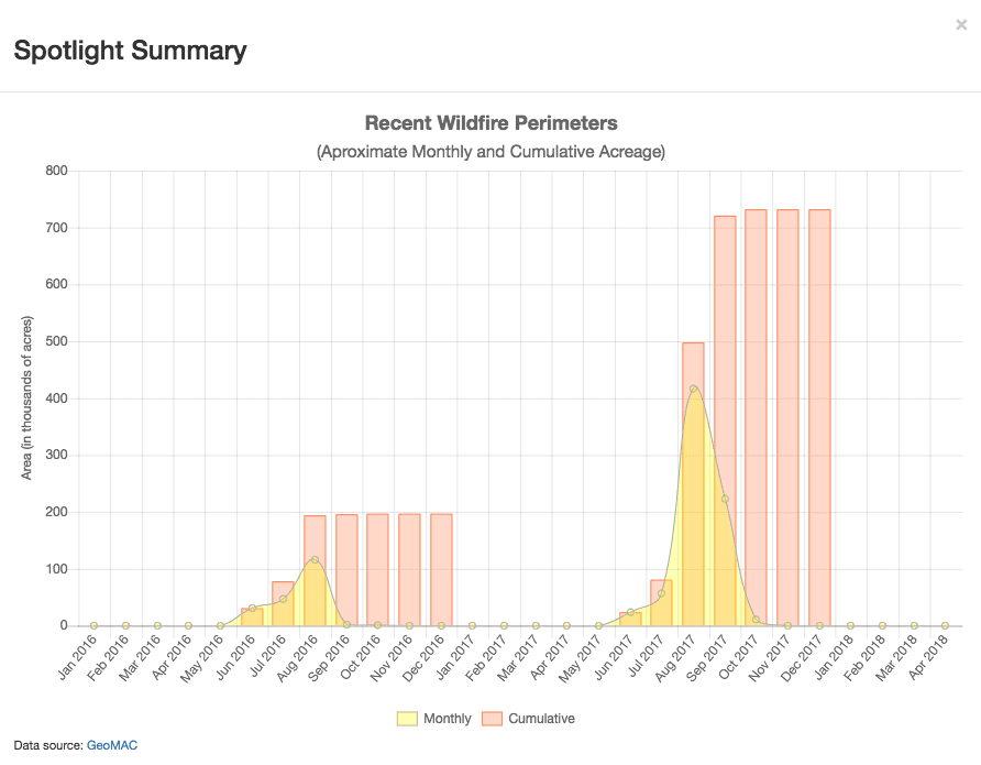
The ‘spotlight’ summary
As with every other HOWL ‘spotlight,’ clicking on the Summary label on the menu bar at the top of the application will pop up a chart providing an at-a-glance view of the data in this ‘spotlight.’
Wildfires are pretty regular events here in the Pacific Northwest. This new HOWL ‘spotlight’ will give you the opportunity to keep an eye on large wildfire incidents as they occur. There are many sites that can be used to access this type of information, but as far as I can tell, this is the only one that offers a 3D view of the affected areas.
As always, please contact me if you have any feedback or if you see any mistakes that need fixing.
A note of caution: Due to the tactical nature of the GeoMAC data, there might be inconsistencies and substantial variations across reports. Locations and perimeters are approximate, and the GeoMAC team makes it quite clear in their site that the data is provided for informational purposes only and do not necessarily represent the ‘official’ incident locations and perimeters.